In today’s architecture, engineering, and construction (AEC) industry, accuracy is no longer optional — it’s the foundation of project success. Every stage, from concept design to final handover, depends on the reliability of initial data. Even minor discrepancies at the start can trigger a cascade of problems: design conflicts, on-site clashes, budget overruns, and project delays.
One of the most significant advances in recent years has been the seamless integration of 3D laser scanning with Building Information Modeling (BIM). Together, these tools create a direct bridge between real-world conditions and digital models, allowing projects to begin with verified measurements and evolve into data-rich, intelligent 3D environments.
Why Accuracy Matters
Traditional surveying methods — tape measures, total stations, manual sketches — still have their place, but they leave room for interpretation and human error. In complex projects, even a few centimeters out of place can lead to misaligned prefabricated components, rework during installation, and significant cost overruns.
3D scanning changes the equation entirely. Modern laser scanners — such as FARO Focus 3D — capture millions of spatial data points in minutes, with typical accuracy of ±2–3 millimeters. This point cloud reflects every visible surface with survey-grade precision and becomes the single source of truth for all stakeholders, reducing the need for return site visits and eliminating uncertainty in the design process.
From Physical Space to Digital Model
The transformation from physical space to a fully usable BIM model follows a structured process:
-
Data Capture – High-precision laser scanners record the geometry of the building, infrastructure, or site from multiple positions, ensuring complete coverage.
-
Point Cloud Processing – The raw scans are aligned, cleaned, and merged into a unified dataset.
-
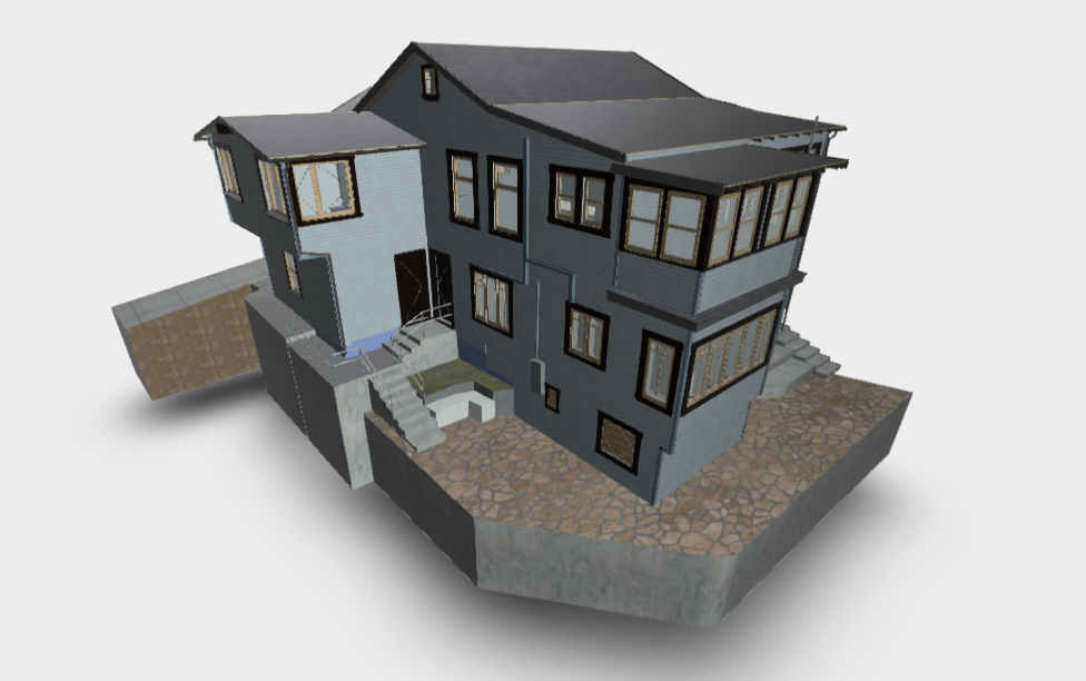
BIM Modeling – Each wall, floor, column, or beam is modeled as an intelligent object, complete with real-world dimensions, materials, and metadata. Deliverables are typically produced at LOD 250–400, depending on project stage.
-
Quality Review – The model is checked for accuracy, completeness, and compliance with the required Level of Detail (LOD).
-
Delivery & Integration – The finished model is provided in compatible formats (RVT, IFC, DWG, NWC) for integration into the project workflow.
Specialized providers such as ScanM2 handle this entire workflow — from raw data collection to delivering ready-to-use BIM models — ensuring that every step meets strict accuracy standards.
Common Conversion Pathways
Different projects call for different approaches to point cloud and BIM integration:
Scan to BIM
Directly converting laser-scanned point clouds into detailed BIM models. This is ideal for documenting existing buildings, supporting renovations, or creating highly accurate as-built models for facility management.
Advantages:
-
Multidisciplinary support (architectural, structural, MEP).
-
Precise geometry that minimizes design errors.
-
Ready-to-use data for clash detection and construction planning.
CAD to BIM
Many organizations still rely on 2D CAD drawings or scanned paper blueprints. CAD to BIM conversion transforms these into intelligent, data-rich 3D models, enabling modern workflows without starting from scratch.
Typical scenarios:
-
Updating legacy project documentation.
-
Preparing models for digital collaboration and visualization.
-
Standardizing drawings for multi-office teams.
As-Built BIM
An as-built model documents the exact state of a project after construction, capturing every change made on-site. These models are invaluable for maintenance, regulatory compliance, and future renovations.
Key benefits:
-
Serves as a permanent digital record.
-
Reduces guesswork for facility managers.
-
Supports lifecycle asset management.
Real-World Applications
The versatility of point cloud and BIM workflows means they can benefit almost any sector within the AEC industry:
-
Historical Preservation – Capturing the intricate details of heritage buildings without invasive surveys.
-
Commercial Renovations – Optimizing layouts for retail, office, and hospitality spaces while ensuring compliance with regulations.
-
Infrastructure Upgrades – Documenting bridges, tunnels, and utilities with precision for maintenance and modernization.
-
Industrial Facilities – Mapping complex production environments to plan expansions, reconfigurations, or safety improvements.
-
Large-Scale Developments – Coordinating multi-building projects with unified, accurate site data.
How to Choose a Reliable Provider
Selecting the right partner is critical to getting the full benefits of 3D scanning and BIM conversion. Look for:
-
Proven experience with projects similar to yours.
-
High-end equipment capable of millimeter-level accuracy.
-
Disciplined workflows for data processing and modeling.
-
Multidisciplinary expertise to integrate architectural, structural, and MEP elements.
Companies like SCANM2 stand out for combining advanced scanning technology with a deep understanding of BIM modeling requirements, ensuring that every deliverable is accurate, usable, and project-ready.
The Future of Point Cloud and BIM in AEC
As the AEC industry embraces digital transformation, point cloud and BIM workflows are becoming standard practice rather than an advanced option. We can expect:
-
Greater automation in point cloud processing and object recognition.
-
Integration with AI to speed up model creation and detect potential design issues.
-
Enhanced interoperability between BIM platforms for smoother collaboration.
-
Increased demand for accurate as-built documentation in facility management and smart building operations.
Conclusion
The ability to transform existing conditions into precise, data-rich BIM models has become a key factor in delivering successful projects. From reducing risk and saving time to enabling better design decisions, point cloud and BIM workflows give architects, engineers, and contractors a powerful advantage.
By working with experienced providers like Scanm2.com, project teams can ensure that their digital models are built on a foundation of accuracy and reliability — turning real-world spaces into actionable design intelligence.